Last time Chris and I were at Parker Dam State Park, we picked up a trail map. When we got home, we analyzed it and pieced together what we thought would be a great hike by combining segments of the Beaver Dam, Snow, Skunk, and Souder's Trail. This past week, we decided to spend one of the days of the weekend out at PDSP giving our loop a whirl. Originally, we'd planned for Saturday, but when we woke up Saturday morning, we decided to run our weekend errands and spend Sunday at the park.
We woke up Sunday morning, showered, and prepared to leave. I packed sandwiches, apples, and a Cliff Bar for Chris and a Lara Bar for myself, then Chris and I filled our CamelBaks. We arrived at the park shortly after 12 PM and found a picnic table so we could enjoy our sandwiches and apples before striking out on the trail. Yesterday was the Annual Woodhick Weekend, which showcases the area's early lumber heritage and history of the park, including the recover of the forest started by the Civilian Conservation Corps following decades of timbering. The event features Woodhick demonstrations and amateur competitions. Competitors and exhibitors alike were beginning to arrive as we were finishing our lunch. We put our cooler bag back in the car and began our sojourn.
 |
| TRAIL STARTS: That man might find unity with nature... |
To access the Beaver Dam Trail, we walked back the Cabin Road. It looked like every cabin was occupied for the Labor Day Weekend. We encountered two people headed the opposite direction shortly after setting out on the Beaver Dam Trail, but before long we left it behind as we met up with the Snow Trail.
 |
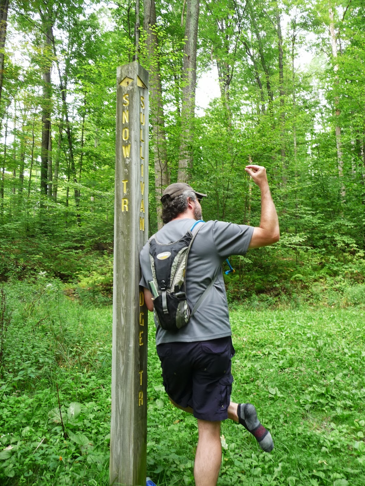
| Chris used the trail sign as a leaning spot while he fished gravel out of his shoe. |
 |
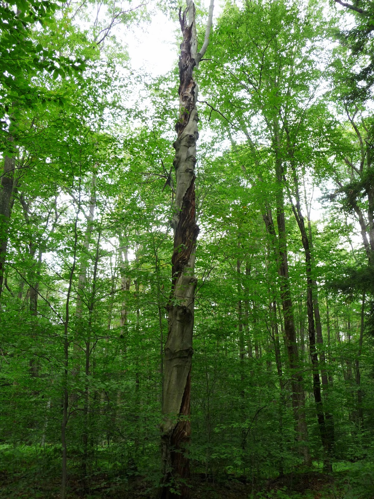
| The Snow Trail |
 |
| While we were hiking, I spotted this snail on the trail. |
 |
| It was cloudy during the first 2/3 of our hike, but it was still very muggy. |
While we were hiking the Snow Trail, we talked about the times we'd hunted along the trail and Chris joked that it would be just our luck if a huge herd of deer went barreling by us. Not five minutes later, we were hiking and chatted when CRASH! SMASH! CLATTER! - two HUGE does when bounding across the trail in front of us. We just looked at each other and laughed. Chris said if it had been hunting season (when all of the leaves would have been off of the trees), we probably could have squeezed off a shot or two and had some fresh venison. If only...
The Snow Trail ends at Moose Grade Road, which we hiked one mile back to Mud Run Road. Along the way, we saw several smashed frogs...like TONS of smashed frogs. And what was weird was there were bees seemingly feeding on the carcasses. Bees! I guess I didn't realized bees ate dead animals, but apparently yellow jackets do?!?
 |
| Moose Grade Road |
 |
| Poor smashed frog! |
We stopped at the intersection of Moose Grade Road and Mud Run Road so Chris could de-gravel his shoe again and so I could tape my broken little toe to the next one, as it was really starting to bother me. We were on Mud Run Road very briefly before we turned onto the Skunk Trail.
 |
| The beginning of the Skunk Trail at Mud Run Road. |
 |
| The Skunk and Souder's Trails are part of the PDSP XC ski trail loop. |
 |
The Skunk Trail was especially buggy.
We got quite an arm workout waving the bugs away on this trail. |
 |
| This fallen tree looked pretty recent; its base was massive! |
 |
| The Skunk Trail crosses Laurel Ridge Road enters into a stand of pines where the trail bed is soft and mossy. |
The Skunk Trail ends at an intersection with the Souder's Trail, which we took back to Fairview Road which connects the Park Office with the Campground.
 |
| Meeting up with the Souder's Trail. |
 |
| We encountered this twisted tree on the Souder's Trail. |
 |
| TRAIL ENDS: ...for man and nature are all one. |
We walked down the Lake Access Road - picking blackberries along the way - to the concession stand where we treated ourselves to a small ice cream, which we ate while we people-watched at the beach. Once we were done, we decided to walk up Fairview Road to the Campground (picking more blackberries - we got about a cup), along the dam, and across the rocks to get back to our car.
 |
| Chris stands on "the drumstick" rock at the bottom of the spillway. |
 |
| A monarch visits the butterfly garden at the park's museum. |
When we got back to the car, we'd logged 7.02 miles with a moving average of 2.6 miles per hour and a moving time of 2 hours and 36 minutes. Chris had our GPS unit tracking our hike, so check out our track and our elevation plot:
We had a great time and - even better - burned a ton of calories while getting a good dose of fresh air and vitamin D. Needless to say, we both slept very well last night! We're making plans to tackle the Moss Hanne Trail next; it's an 11-mile loop at Black Moshannon State Park. Stay tuned!